U.S. Road Signs: Motorist services 2026
Motorist services

A motorist-service sign showing a telephone is available at the exit or location ahead.

Guides motorists to a nearby hospital offering medical care.

Indicates that a campground or camping facility is available in the direction shown.
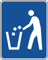
Marks the location of a litter container where travelers can dispose of trash.
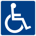
Shows that the facility ahead is accessible to people with disabilities.

A plaque added below the accessibility symbol to indicate van-accessible parking or facilities.
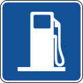
Directs motorists to gasoline fuel available at the exit or location ahead.

Points drivers toward food and dining services nearby.
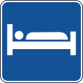
Indicates lodging such as a motel or hotel is available in the direction shown.

Directs travelers to a tourist information center for maps, directions, and local guidance.
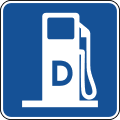
Shows that diesel fuel is available at the fueling location ahead, useful for trucks and diesel vehicles.
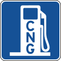
Indicates that compressed natural gas (CNG) is available as an alternative fuel at the location ahead.
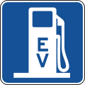
Marks the availability of electric vehicle charging at the exit or facility ahead.
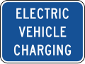
A plaque supplementing a services sign to note that electric vehicle charging is available.
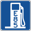
Shows that ethanol (E85) alternative fuel is available at the fueling location ahead.
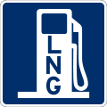
Indicates that liquefied natural gas (LNG) is available as an alternative fuel ahead.
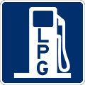
Shows that liquefied petroleum gas (propane/LPG) fuel is available at the location ahead.
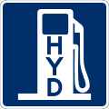
Indicates that hydrogen fuel is available for fuel-cell vehicles at the location ahead.
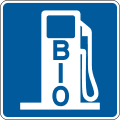
Marks the availability of biofuel as an alternative fuel option at the fueling location ahead.

Directs recreational-vehicle drivers to a sanitary dump station for emptying RV holding tanks.
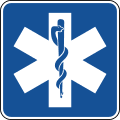
Points motorists toward emergency medical services available nearby.

A plaque used with the EMS symbol to specify that a hospital is the type of medical facility available.
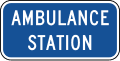
A plaque paired with the medical symbol to indicate an ambulance station is located nearby.
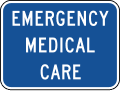
A plaque clarifying that emergency medical care, such as an urgent-care facility, is available at the location.
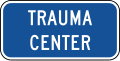
A plaque added to the medical symbol to indicate a trauma center is available for serious injuries.
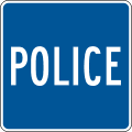
Directs motorists to a police station or law-enforcement services nearby.
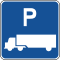
Marks a truck parking area where commercial drivers can stop and rest.
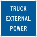
A plaque indicating that external power hookups for trucks are available at the parking area.
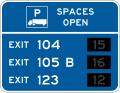
Shows real-time truck parking availability at a specific exit number so drivers can plan a rest stop.
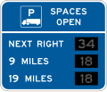
Displays truck parking availability with the distance to the parking location ahead.
.svg.png&w=256&q=75)
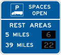
Shows truck parking availability by distance, indicating when the upcoming parking area is full.
Indicates truck parking availability at a rest area ahead so commercial drivers can plan a stop.
.svg.png&w=256&q=75)
Shows truck parking availability across three rest-area facilities, helping drivers find open spaces.
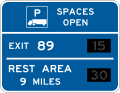
Combines truck parking availability for multiple locations on one sign to guide drivers to open spaces.
.svg.png&w=256&q=75)
Displays combined truck parking availability across three exits so drivers can choose where to stop.
.svg.png&w=256&q=75)
Shows combined truck parking availability for a rest area and an exit, helping drivers pick an open location.
.svg.png&w=256&q=75)
Displays combined truck parking availability for both a rest area and a weigh station ahead.
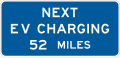
Tells electric-vehicle drivers the distance to the next EV charging station so they can plan a charging stop.

A plaque noting the distance to the next available services along the route.
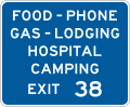
A general-services sign listing available amenities along with the exit number where they are found.
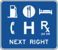
A general-services sign displaying up to six service symbols with an action message directing drivers to them.
.svg.png&w=256&q=75)
A general-services sign showing up to six service symbols along with the exit number to reach them.
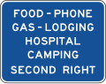
A general-services sign with an action message telling drivers how to reach the listed amenities.

A plaque for rural interchanges displaying up to three service symbols available near the exit.

A single-line plaque listing general services available at a rural interchange.

A two-line plaque listing general services available at a rural interchange.
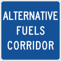
Marks an alternative fuels corridor where charging and alternative fueling options are available along the route.

A single-line plaque identifying the route as part of a designated alternative fuels corridor.
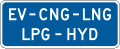
A two-line plaque identifying the route as a designated alternative fuels corridor with services ahead.

Directs motorists to a pharmacy available nearby.

A plaque noting that the service, such as a pharmacy, is open 24 hours.

A blue motorist-service sign showing the TDD/TTY symbol, directing drivers to a telephone equipped for deaf or hard-of-hearing callers at the upcoming rest area or facility.

Marks where wireless internet (Wi-Fi) access is available, typically at a rest area, welcome center, or other roadside stop along the route.

Have a question? Contact Us
Have questions about preparing for your DMV exam or need assistance with our tools? Reach out to us — we're here to help you succeed on your journey to getting your license

Send us a message
By sending this message, you agree to our terms and conditions.